For a long time I rather was not thinking about navigation: on the streets, there is no need to: but on the trails this is something else…
My first approach was quite simple: you have a phone anyways with you, why not use it with a proper app to navigate. Trying out komoot, I got out and started running in unknown territory 🙂
First it was quite ok: there was a voicedirection and I had bluetooth headphones in but everytime I wanted to check where exactly I am now, what the direction was again because I didn’t quite get it the first time, it became hideous and more importantly: it’s very interrupting to check the phone every few k’s just to check the directions.
I tried this out another few times and there was a key-moment after which I decided I need a better solution: I was running in a quite remote area, still in vienna, the Lobau. First I got completely lost: it’s a flat area and I was unintentionally just running in circles. Secondly this was also a very popular nude bathing area: and I got by there several times. At least often enough to be watched suspiciously by some nude guys who just had seen me pass by 😉
At the time, I was already quite into the garmin eco-system so my choice fell on the fenix 5 (not 5X, not 5s and 5plus was not out yet). Another point, apart from the navigation, for this was the barometrical elevation-sensor and the battery-lifetime.
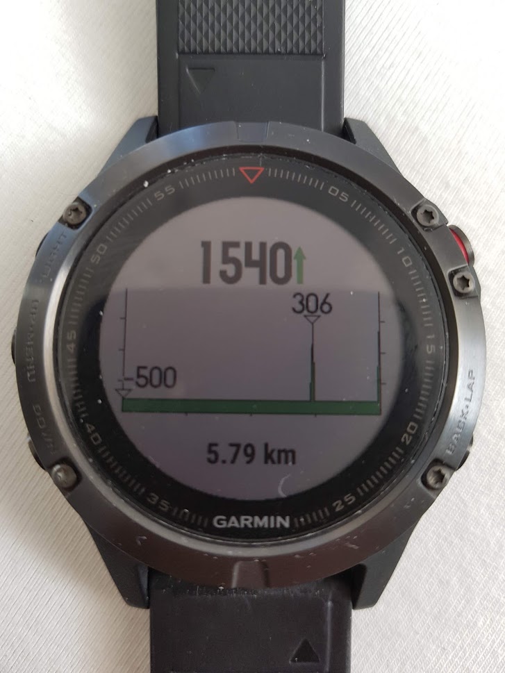
Using the garmin connect, I tried to get a track on the watch and following it. First I tought the turn-by-turn was quite cool. After 5 runs I started hating it… First it got annoying, secondly, for really large tracks, 30k+, the watch was not able to save all point correctly and it became very unreliable.
Another point against this was, that the track-creator is not able to mark certain points (like a fountain, mountain-tops, etc…). There was the way to create something like this as a waypoint, but this was then as reliable as the turn-by-turn navigation.
So I needed another way to create the tracks and get it on the watch: I tried basecamp.
Equipped with open-source maps and basecamp I tried planning and navigating through tracks there: which was fine at first, until I saw a huge flaw: the elevation-graph on the tracks for navigation was broken. I reproduced the bug and informed garmin, but at this time, basecamp was already out of service and I don’t have any hope that this will be fixed anytime soon…
I gave garmin explore a shot, and this was somehow not finished… Managing tracks was fine, managing waypoints was fine: but creating tracks simply not possible. I though ok, at least a decent management-application for getting existing tracks in order and on the watch: but then they changes something: they removed elevation-parameters from imported tracks. This made it again useless and I gave up on it.
You can see I’ve tried quite a lot and the solution I’m currently stuck with is Gpsies for creating the track and still basecamp to manage them. And since there is no decent app for this stuff on the phone, I rely on the good old cable to get them to the watch.
Recent Comments